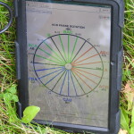
Utilizing our proprietary software “FMGPS,” our powerful platform can quickly, accurately, and efficiently collect data on the field with tablet computers and GPS receivers. Our software is specifically tailored to water, gas, and electric utilities. In a recent software update, we have added the ability to upload digital photographs from a camera to our software.
 Global Mapping Solutions has been conducting precise and comprehensive GPS field inventories for over 23 years. We have conducted over 70 successful field inventories during this period of time. Many of these inventories have been conducted for electric utilities throughout the United States and Alaska. In addition, we typically take and record digital images of electric infrastructure, to include transformer nameplates, incorporating the pictures into the resulting GIS system.
 GMS performs detailed checks and takes extensive quality control measures on data it collects in the field. The first step occurs as the two-person crew is collecting the data. The person not operating the computer on the crew calls out the relevant information to the person operating the data collection system. The next step occurs when the project manager field checks (QA/QC) the data after the completion of the data set (circuit). The final step occurs when the project manager runs numerous quality control checks on the data using python scripting, Arc-GIS, and Total Fit ™ software. We feel that applying this quality control checks on the collected data we can deliver to the client 99% accurate data.
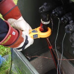
 On a few of the projects that GMS has conducted over the past years, GMS personnel has taken legacy GIS data and made significant improvements by repairing deficiencies and enhancing the data by adding context such as digital images. An example of this might be using a Phase ID system such as Origo to validate system phasing or using the system to fix phasing errors on an electric system.
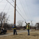
 On most urban and suburban electric systems joint use contacts on electric poles are often a frequent occurrence. The significance of such goes beyond the billable event that goes with counting joint use contacts. Often there are compliance violations when joint exists on electric poles. Also, pole loading as a result of joint use on an electric pole is something that must be taken into account. On field inventories conducted by GMS, a full accounting of joint use contacts is made as a result of the inventory. Digital images of such contacts are archived and made part of the field data collection. In addition, any compliance violations are noted.
 Many inventories conducted by GMS involve extensive underground primary and secondary infrastructure. Many times there is uncertainty on the location of linear segments of the URD system. As a result, GMS deploys the Rigid SR-20 line locator on our field inventory projects to accurately map underground electric linear segments. This is incorporated into our field data collection process. This reduces ‘tickets’ for 811 locates (call before you dig), and improves engineering efficiency.


